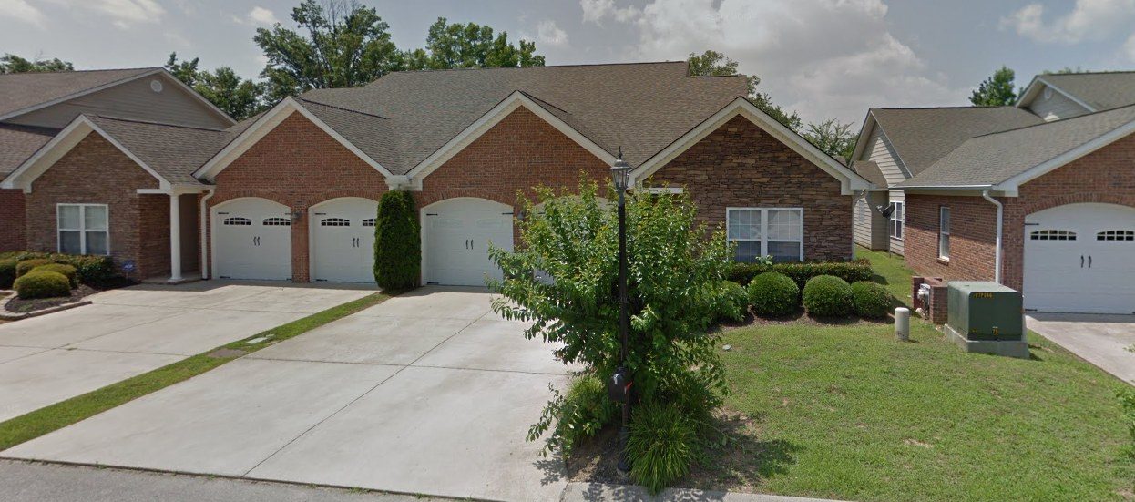
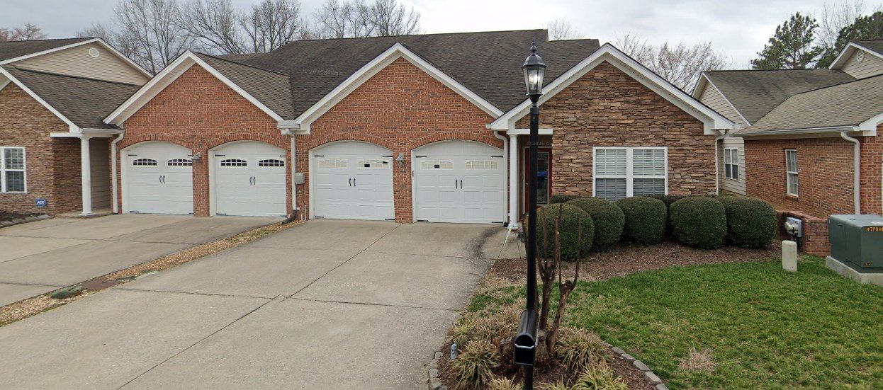
Lot 10, Friar Branch Townhomes, Chattanooga, Tennessee
The house on Laramie Circle
Built in 2008-09 on an old farm field off Noah Reid Road, it sat unsold for years, spent most of a decade as a rental, and became Gary and Gloria Scott's home in 2023.
6243 Laramie Circle in early spring 2023, when it was listed for sale. Gary and Gloria bought it that April. 2023 listing photo (Crye-Leike, REALTRACS MLS 3226955).
The story in brief
For most of the last century this was open farmland at the edge of East Brainerd. Friar Branch, a small creek, runs just to the west.
In 2004 a Chattanooga builder, S.E.W. Construction, run by its president Sherrill E. White, bought the land, had it rezoned for townhouses and laid out Friar Branch Townhomes.
Lot 10 was one of the last of the first rows to be finished. The townhome went up in 2008-09 and was offered for sale new, but it did not sell.
From 2015 to 2023 it belonged to an owner who lived elsewhere and almost certainly rented it out: mail and visitors still come looking for an earlier resident. Gary and Gloria, who bought it in April 2023, are the first owners to live in it.
How the Scotts came to Laramie Circle
The house has had only one family make it home. This is their road here, from the Cumberland Plateau to Laramie Circle. Solid pins are proven places; dashed pins are close but approximate. The full Scott story, back to 1755, is at scott-house.amplifi.studio.
1 of 7
1
Lancing
about 1925 to 1961
Who: John and Alta Scott; Russell, Gary's father, grows up here Likely
Gary's grandparents, John Long Scott and Alta May Clark Scott, raised eight children in a white frame house beside the Lancing Presbyterian Church in Morgan County. John worked at the Lancing depot. Their son Russell Julian Scott, Gary's father, grew up here.
Lancing in 1952, with the area of John and Alta Scott's house near the Presbyterian church. USGS Lancing quadrangle, 1952. Markings added."Grandpa Scott," John Long Scott, at Lancing in the 1950s. Scott-Clark(e) Family Association collection.The Scott family at Lancing in the 1950s. Scott-Clark(e) Family Association collection.
2
Oakdale
1920s to 1951
Who: Margaret Grey Patching, Gary's mother Proven by records
Gary's mother, Margaret Grey Patching, was born in Oakdale in 1923 and grew up the daughter of Walter Patching, who ran a grocery on the old U.S. 27 from the 1920s until 1951.
The Walter Patching grocery store in Oakdale, run from the 1920s to 1951. Margaret grew up the grocer's daughter. Scott-Clark(e) Family Association collection.1950 census: Walter Patching, retail grocery merchant, on Highway 27 outside Oakdale. 1950 U.S. Census, National Archives.
3
727 Dale Avenue, Knoxville
about 1948 to 1950
Who: Russell and Margaret, newlyweds Proven by records
Russell and Margaret married in 1947. The April 1950 census found them in Apartment 2 at 727 Dale Avenue, near the University of Tennessee, where Russell finished his degree in transportation.
April 1950 census: Russell J. Scott, 29, and Margaret P., 26, at 727 Dale Avenue, Apartment 2, Knoxville. 1950 U.S. Census, National Archives.1949: a letter from Russell at 727 Dale Avenue, Knoxville. Scott family letters, scottclarke.org.
4
Chattanooga
1950s to about 1980
Who: Russell and Margaret raise Nancy and Gary Proven by records
Russell made his career with the airlines, and the family lived "for many years" in Chattanooga, where they belonged to Brainerd United Methodist Church. Gary grew up here with his sister Nancy. The pin marks the church. It is about four miles from Laramie Circle.
Margaret with Nancy and Gary. Scott-Clark(e) Family Association collection.Gary, Alan, Nancy, Bobby and Carole in Chattanooga. Scott-Clark(e) Family Association collection.
5
Oakdale, in retirement
about 1980 to 2013
Who: Russell and Margaret back home in Morgan County Likely
After Russell retired from United Airlines in 1980, he and Margaret went home to Morgan County. They are buried side by side at Morgan Memorial Gardens in Wartburg.
Russell and Margaret's stone, Morgan Memorial Gardens, Wartburg. Find a Grave.
6
9914 Stewarts Ferry Pike, near Lebanon
1993 to 2024
Who: Gary and Gloria Scott, Abigail and Arthur Proven by records
Gary and Gloria bought eight wooded acres near Gladeville about 1993, and Gary built the family house there in 1997. They raised Abigail and Arthur there and sold it in March 2024.
The house in October 2023, with the flag on the front porch. 2023 listing photo (RealTracs MLS).The 2023 drone photo, looking south, with both of Gary's lots outlined in green. Lot 8 and the house are on the right. 2023 listing photo (RealTracs MLS).
7
6243 Laramie Circle
2023 to today
Who: Gary and Gloria Scott Proven by records
On April 12, 2023 Gary and Gloria bought Lot 10 of Friar Branch Townhomes for $350,000, about four miles from the Brainerd church Gary grew up in. By the 2025 tax year the county was mailing their bill to the house itself. They are the first owners to live here.
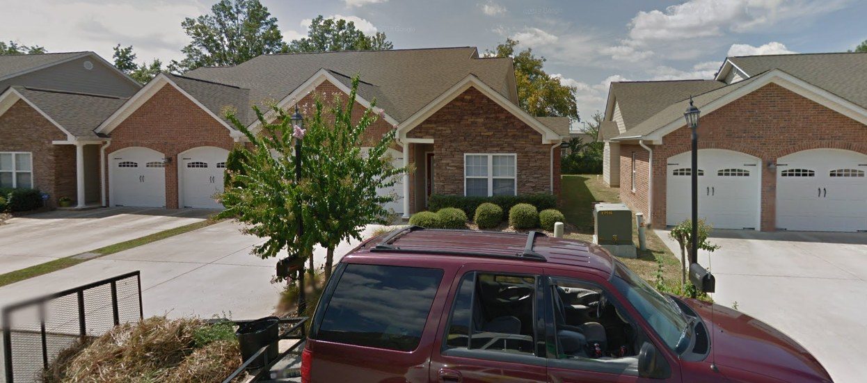
6243 Laramie Circle in early spring 2023, when it was listed for sale. Gary and Gloria bought it that April. 2023 listing photo (Crye-Leike, REALTRACS MLS 3226955).February 2026: Gary and Gloria's home. Google Street View, Feb 2026.
The family tree
The family who lives at 6243 Laramie Circle today: everyone we know of, from Gary back to Thomas Scott in 1755, plus the Patching, Clark, Jones and Webb families who married in. Tap anyone to move the tree to them, or pick a name from the list. A solid outline means records prove it; dashed means likely; dotted means it comes only from the family's own papers or an unchecked lead. Living people show names only.
Proven by recordsLikelyFamily story or unproven leadLiving
Swipe the tree sideways to see more of the family.
Before the house
What the ground at 6243 Laramie Circle was before Friar Branch Townhomes existed.
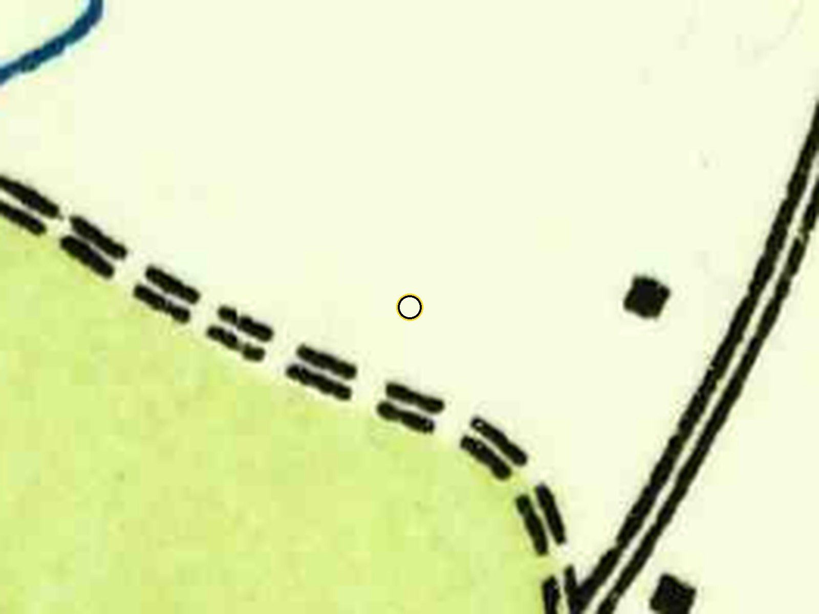
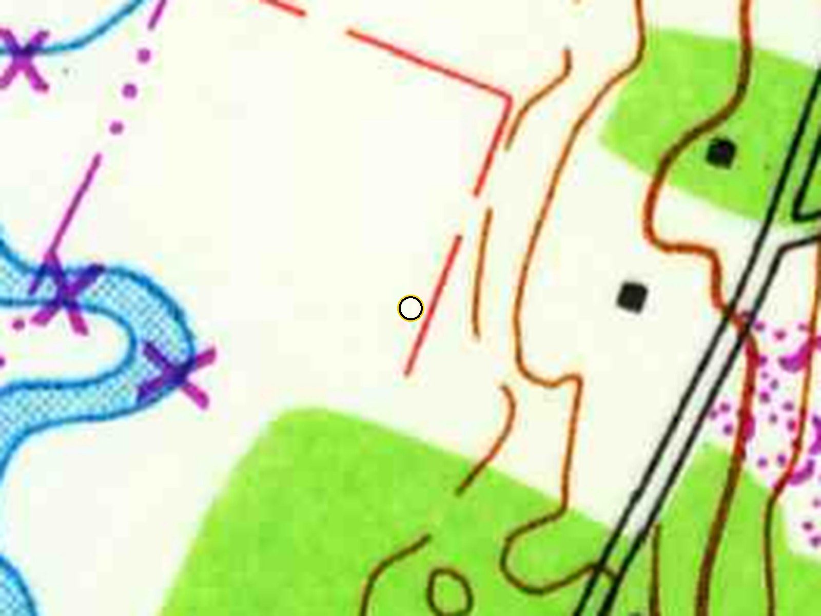
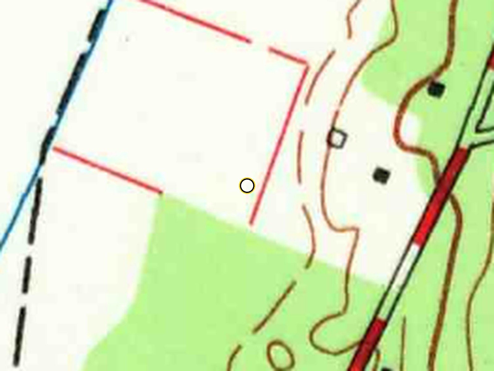
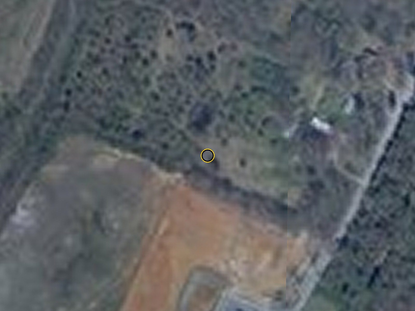
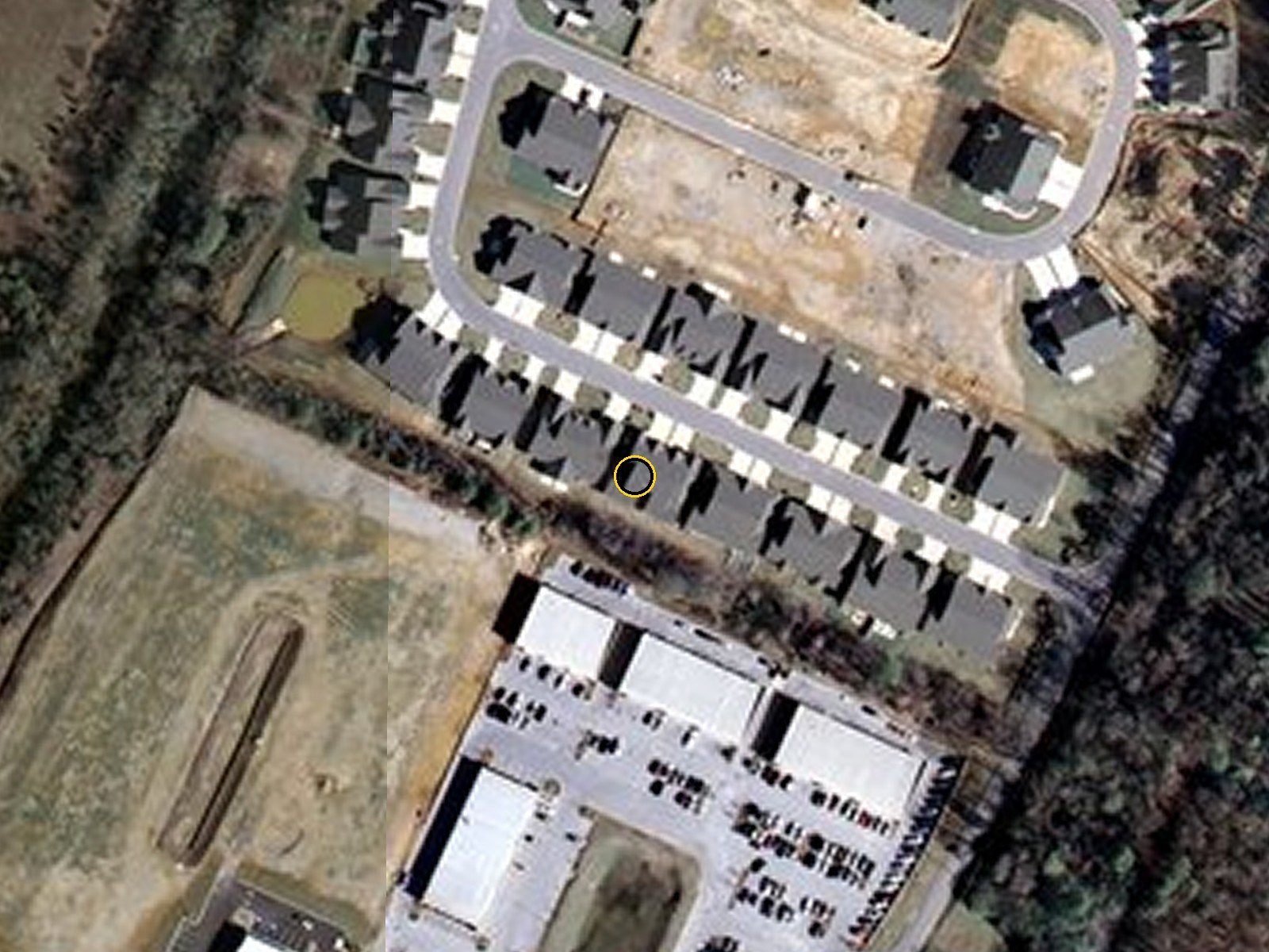
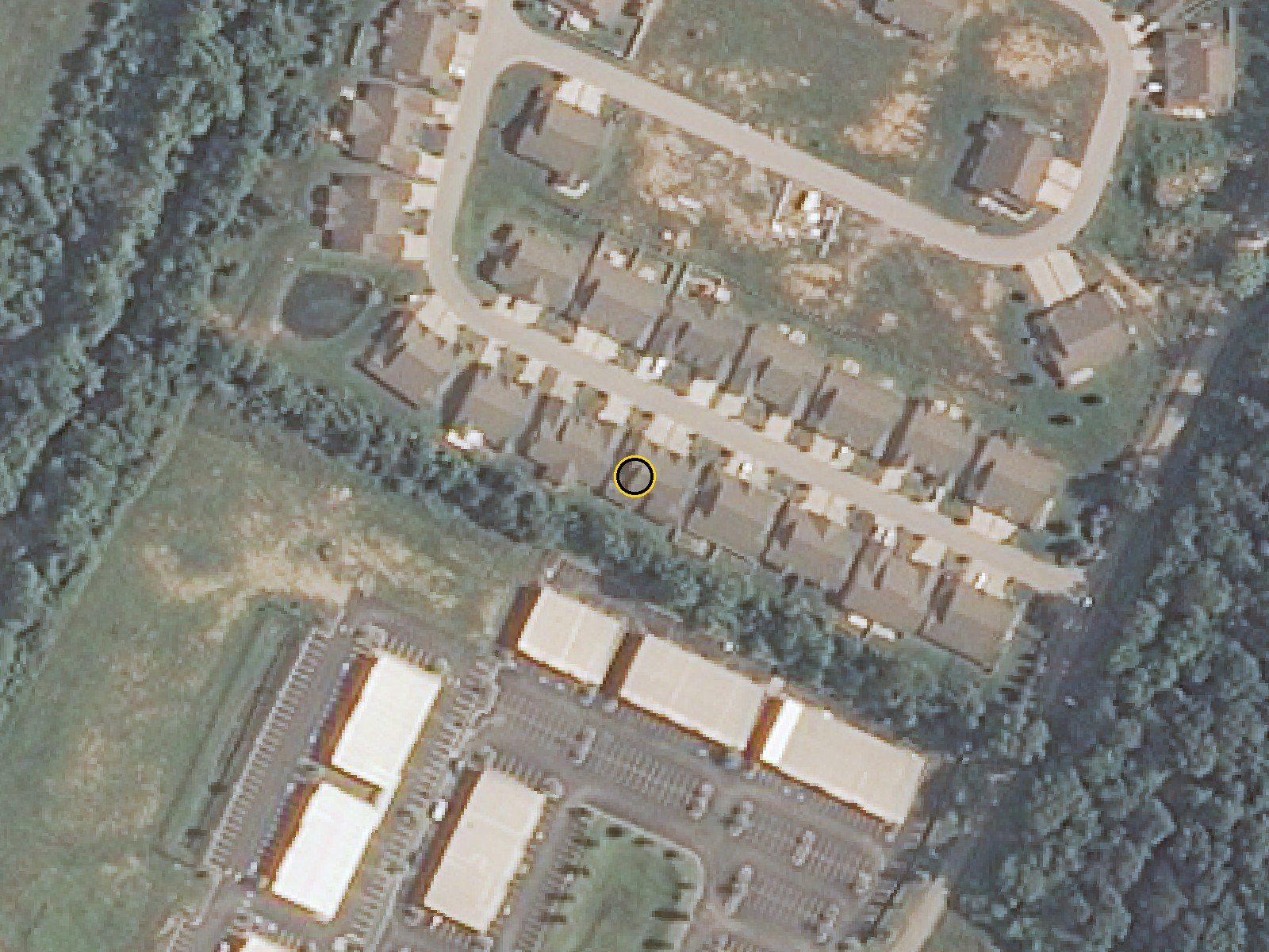
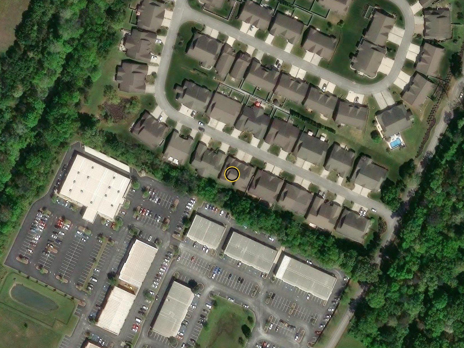
Drag the slider to watch the same spot across ninety years. The yellow ring marks Lot 10. The first three frames are government survey maps; the rest are aerial photographs.
The 1935, 1958 and 1969 maps all show open, unwooded land here, crossed by a farm lane, with a farmhouse a short block to the east. That farmhouse spot is inside the subdivision today. By 2002 the field had gone to scrub.
The creek just west is Friar Branch, which rises south of Interstate 75 and runs into South Chickamauga Creek. When the city dug a sewer lift station on Friar Branch, workers turned up plant fossils from the last ice age, written up by University of Tennessee botanists. East Brainerd was still "largely farmland" in 1967, and it came into the City of Chattanooga in 1972.
Noah Reid Road
The townhomes' land is described in the recorded papers the old way: "Beginning in the center of Noah Reed Road," running along land that Noah Reid sold to O. P. Worley in December 1923, back to "the middle of Spring Creek." A Noah R. Reid of Chattanooga died in March 1935; he is very likely the man the road is named for, though no record found so far says so.
The land the townhomes were built on, described in the old way: "Beginning in the center of Noah Reed Road," along land that Noah Reid sold to O. P. Worley in 1923, to "the middle of Spring Creek." It also takes in Lot 1 of McKelvey Gardens. Declaration of Covenants for Friar Branch Townhomes, Exhibit A, Book GI 8883, Page 606.
The family who sold the farm
On July 21, 2004 the land passed to the builder. The county's sale record names the sellers as "McKelvey, Barbara Faye Askew" and others (Book 7216, Page 846). A Barbara Askew McKelvey of Chattanooga died January 3, 2016, at 79. She is very likely the same woman, born an Askew, which would make this Askew family land. The tract also took in Lot 1 of a small earlier subdivision called McKelvey Gardens. The 2004 deed itself, which would name every seller and where the land came from, sits behind the Register of Deeds' paid search.
Who built it
The company, the man behind it, and who else had a hand in Lot 10.
S.E.W. Construction, Inc. was the developer and builder of Friar Branch Townhomes. It was a Chattanooga company formed on April 21, 2003, and its president was Sherrill E. White, who signed its deeds and the neighborhood's rules. The letters S.E.W. match his initials, which is very likely where the name came from. He had been building in Chattanooga since at least 1977, when he formed an earlier company, Sherrill White Construction, Inc. The state licensed S.E.W. as a building contractor (license 50690) from June 11, 2003; the license expired on June 30, 2008.
The state's record of the building company: S.E.W. Construction, Inc., formed April 21, 2003, closed by the state in 2008. Tennessee Secretary of State business records.
June 2004S.E.W. Construction asks the city to rezone 7229, 7231 and 7233 Noah Reid Road from single-family to townhouse and zero-lot-line (case 2004-105). The City Council takes it up in July.
July 21, 2004The company buys the land from the Askew-McKelvey family.
2005It records the neighborhood rules as the "Developer": no house without its written approval of the plans, at least 1,700 square feet each, no fences without permission.
2006The lots are recorded (Plat Books 80 and 81), the city issues a grading permit for "Friar Branch Townhomes," and the first homes go up. Lots 1 to 8 are built and sold new in 2006-07 for $183,000 to $218,000.
January 2007The local home builders' association names SEW Construction one of the top five building companies by permits and gives it a plaque.
2008The housing market turns. Lot 9 sells new in February. On June 23, S.E.W. deeds Lot 10, and Lot 11 next door, to James C. Rogers Jr. A week later, on June 30, the company's contractor license expires, and that December the state closes the company for not filing its annual report.
2008-09The townhome on Lot 10 goes up. RE/MAX lists it as new on November 24, 2008, and the county taxes it as a finished house for the first time in 2010.
June 2004: the builder asks the city to rezone the Noah Reid Road land for townhouses. Chattanoogan.com, Planning Commission agenda, June 3, 2004.January 2007: the local home builders' association names SEW Construction one of the top five building companies by permits. Chattanoogan.com, Jan 24, 2007.
The first page of the neighborhood's rules, recorded by "S.E.W. Construction, Inc., hereinafter referred to as Developer." No house could be built until the developer approved its plans, and every home had to have at least 1,700 square feet. Declaration of Covenants for Friar Branch Townhomes, Hamilton County Register of Deeds (copy posted by the homeowners' association).
The signature page of the same declaration: Sherrill E. White signed it as President of S.E.W. Construction, Inc. Declaration of Covenants for Friar Branch Townhomes, Book GI 8883, Page 605.May 17, 2006: Sherrill E. White, "President of S.E.W. Construction, Inc.," signs the deed for a new townhome four doors down (Lot 4). Warranty deed, Book 7957, Page 595, Hamilton County Register of Deeds.
Who finished Lot 10
The builder's company was planned to build every unit itself: the rules say the "Developer proposes to construct a townhouse on each of the remaining lots." But Lot 10 changed hands before its house was done. The tax record shows bare land worth $5,000 through 2008, a partly built house in 2009, and a note on the 2010 bill: "*PU NEW TOWNHOME FOR 2010," the county's way of saying it picked up a new finished townhome. So the house was built between mid-2008 and the end of 2009, while James C. Rogers Jr held the lot. Because S.E.W.'s contractor license ran out on June 30, 2008, the finishing work had to be done under someone else's license or by the owner himself. Who that was has not been found, and no Tennessee company in Rogers's name turned up.
The 2007 county tax bill: the lot still belonged to the builder, S E W Construction, and was taxed as bare land ($5,000 assessed). Hamilton County Trustee, 2007 tax bill.The 2010 tax bill. The first line reads "*PU NEW TOWNHOME FOR 2010": the county picked up the finished house for the first time. The owner's street address is left out here. Hamilton County Trustee, 2010 tax bill.
Who else worked on it
The city's open permit records go back to 2006 but do not name contractors for these years, and they show no permits at all on Laramie Circle from 2008 to 2010. A 2006 building permit for a "new townhouse" filed under the street's first, temporary house numbers (B-06-825, old number 2308 Laramie Circle) is likely this lot's first start, but only one old number has been matched to a lot so far.
One trade is on record for the subdivision: a federal court opinion about the builder's insurance names G. Robert's Company, Inc. (Greg Roberts) as the contractor who put in the plumbing and sewer lines on a 2006 Friar Branch unit. The state's records show that company was formed in August 2005, just as Friar Branch got under way, and closed in 2009. It is likely the same plumber worked on other S.E.W. units, but that is not proven for Lot 10. Other trades have not been found yet. Neighbor permits from 2007 show the kind of equipment the builder used: Tappan 4-ton split heat pumps, 200-amp electric service and gas fireplaces.
The city permit files in the Land Development Office (1250 Market Street) would name the contractor and subcontractors on each 2006-2009 permit. The 2008 deed to Rogers (Book 8697, Page 792) would show what he paid and any loan behind it.
The house
Lot 10, Friar Branch Townhomes, Plat Book 80, Page 93.
Friar Branch Townhomes today. Each number is a lot and the year the county says its house was built. Lot 10 (yellow) and Lot 11 next door were the last two in this row, 2009. Chattanooga city parcel lines and Hamilton County building years, over Esri World Imagery.
Built
2008-09; first taxed as a finished house for 2010
Living space
1,924 sq ft, all on one floor
Rooms
Three bedrooms, two baths, family room, separate dining room, laundry, sunroom
Garage
Two-car attached, 504 sq ft
Outside
Brick and stone front, covered back patio, small fenced yard
The county's floor-plan sketch: 1,924 sq ft of living space on one floor, a 504 sq ft two-car garage, a screened porch and a small front porch. Hamilton County Assessor of Property.
The same rooms in 2008, 2012 and 2023
The builder's 2008 ad promised "stainless steel appliances, jetted tubs, granite counter tops, lots of crown molding, tile and hardwood, trey ceilings in master bedroom, sunroom, landscaped yards." The 2012 photos show the rooms new and empty. By 2023 the dark wood floors had been replaced with lighter plank flooring, but the kitchen, the fireplace and the tub are the originals.
November 2008: the new building, when RE/MAX listed the unit for $239,900 as one of the "beautiful new one level townhomes." RE/MAX listing photo, Nov 24, 2008 (via Realtor.com).A furnished, staged room from the same November 2008 listing. It is probably a model unit used to sell the new townhomes, not this unit's own living room. RE/MAX listing photo, Nov 24, 2008.
April 2012: the unit, still unsold, relisted for $219,900. Bridge City Realty listing photo, Apr 16, 2012 (via Realtor.com).April 2012: the family room, empty and new-looking, with the corner fireplace and the original dark wood floor. Bridge City Realty listing photo, Apr 16, 2012.April 2012: the same kitchen as today, never lived in. Bridge City Realty listing photo, Apr 16, 2012.
The kitchen: glazed cream cabinets, granite counters and stainless appliances, original to the 2008-09 build. 2023 listing photo.The family room with its corner gas fireplace. 2023 listing photo.The separate dining room, with the trey ceiling and crown molding the builder advertised. 2023 listing photo.
The jetted tub in the primary bath, the same one in the 2012 listing photos. 2023 listing photo.The covered back patio. 2023 listing photo.The back of the row and the small fenced yard. 2023 listing photo.
Who lived here before
Every owner of Lot 10, from the county deed list and twenty years of tax bills.
The county tax bill shows where each owner wanted the bill mailed. No owner before Gary and Gloria ever had it sent to the house, so none of them lived here. That tells us who owned it, not who lived in it. The empty years were 2008 to 2015; from 2015 to 2023 someone almost certainly did live here, as renters.
2004-2008S.E.W. Construction, Inc., the builder. Bare lot. Bills to the company's post office box.
2008-2012James C. Rogers Jr. took Lots 10 and 11 from the builder in June 2008, and the townhome was finished on his watch. RE/MAX listed it new at $239,900 in November 2008; Bridge City Realty listed it again at $219,900 in April 2012, and the photos show it empty and never lived in. It did not sell. Bills went to his address in Ooltewah, not the house.
2012-2014David E. Graham, who took Lots 10, 11 and 69 in June 2012. Bills went to a business address in Ooltewah.
2014-2015Southeast Bank, which took a group of Friar Branch lots in one deed in August 2014. Google's June 2014 Street View shows the unit kept up but empty-looking: no cars, no signs.
2015-2023Deborah Evans bought Lot 10 and Lot 11 next door from the bank on the same day, September 25, 2015, for $150,000 each, without an ordinary public listing. Her bills went to a post office box in Cleveland, Tennessee. She still owns Lot 11. She lived elsewhere and bought two units at once, the usual pattern of a landlord, and Gary and Gloria still get mail and visitors looking for an earlier resident, so the house was almost certainly rented in these years. It was never advertised on the big rental sites. The renters' names are left off this page.
2023Listed for sale empty and freshened up on February 8, 2023, at $349,000 by Sue Sievers of Crye-Leike. Sold April 13.
2023-todayGary and Gloria Scott. First owners to make it their home and have the bill sent to the house.
The county's list of every deed for Lot 10. The "Grantor" on each row is the seller. Hamilton County Assessor of Property, sales report, Oct 2026.
The records
Every record behind this story. Tap any one to see it large.
The county's list of every deed for Lot 10. The "Grantor" on each row is the seller. Hamilton County Assessor of Property, sales report, Oct 2026.The 2007 county tax bill: the lot still belonged to the builder, S E W Construction, and was taxed as bare land ($5,000 assessed). Hamilton County Trustee, 2007 tax bill.The 2010 tax bill. The first line reads "*PU NEW TOWNHOME FOR 2010": the county picked up the finished house for the first time. The owner's street address is left out here. Hamilton County Trustee, 2010 tax bill.The county's floor-plan sketch: 1,924 sq ft of living space on one floor, a 504 sq ft two-car garage, a screened porch and a small front porch. Hamilton County Assessor of Property.Friar Branch Townhomes today. Each number is a lot and the year the county says its house was built. Lot 10 (yellow) and Lot 11 next door were the last two in this row, 2009. Chattanooga city parcel lines and Hamilton County building years, over Esri World Imagery.The state's record of the building company: S.E.W. Construction, Inc., formed April 21, 2003, closed by the state in 2008. Tennessee Secretary of State business records.The first page of the neighborhood's rules, recorded by "S.E.W. Construction, Inc., hereinafter referred to as Developer." No house could be built until the developer approved its plans, and every home had to have at least 1,700 square feet. Declaration of Covenants for Friar Branch Townhomes, Hamilton County Register of Deeds (copy posted by the homeowners' association).The signature page of the same declaration: Sherrill E. White signed it as President of S.E.W. Construction, Inc. Declaration of Covenants for Friar Branch Townhomes, Book GI 8883, Page 605.May 17, 2006: Sherrill E. White, "President of S.E.W. Construction, Inc.," signs the deed for a new townhome four doors down (Lot 4). Warranty deed, Book 7957, Page 595, Hamilton County Register of Deeds.The land the townhomes were built on, described in the old way: "Beginning in the center of Noah Reed Road," along land that Noah Reid sold to O. P. Worley in 1923, to "the middle of Spring Creek." It also takes in Lot 1 of McKelvey Gardens. Declaration of Covenants for Friar Branch Townhomes, Exhibit A, Book GI 8883, Page 606.June 2004: the builder asks the city to rezone the Noah Reid Road land for townhouses. Chattanoogan.com, Planning Commission agenda, June 3, 2004.July 2004: the rezoning goes to the City Council. Chattanoogan.com, City Council agenda, July 16, 2004.January 2007: the local home builders' association names SEW Construction one of the top five building companies by permits. Chattanoogan.com, Jan 24, 2007.November 2008: the new building, when RE/MAX listed the unit for $239,900 as one of the "beautiful new one level townhomes." RE/MAX listing photo, Nov 24, 2008 (via Realtor.com).A furnished, staged room from the same November 2008 listing. It is probably a model unit used to sell the new townhomes, not this unit's own living room. RE/MAX listing photo, Nov 24, 2008.April 2012: the unit, still unsold, relisted for $219,900. Bridge City Realty listing photo, Apr 16, 2012 (via Realtor.com).April 2012: the family room, empty and new-looking, with the corner fireplace and the original dark wood floor. Bridge City Realty listing photo, Apr 16, 2012.April 2012: the same kitchen as today, never lived in. Bridge City Realty listing photo, Apr 16, 2012.August 2011: the finished row on Laramie Circle, landscaped, garage doors closed. Google Street View, Aug 2011.June 2014: the unit while it sat with a lender. No cars, no signs. Google Street View, Jun 2014.February 2026: Gary and Gloria's home. Google Street View, Feb 2026.1935 government map. The yellow ring is where Lot 10 is today: open farmland with a farm lane, and a farmhouse a short block east. USGS East Chattanooga quadrangle, 1935. Ring added.1958: still open land. Friar Branch, the creek the subdivision is named for, runs just to the west. USGS East Chattanooga quadrangle, 1958.1969: the same farmhouse and fields, a few more buildings nearby. USGS East Chattanooga quadrangle, 1969.April 2002: the old field has grown up in scrub. Two years later it was sold to the builder. USGS high-resolution orthoimagery, Apr 2, 2002 (low-resolution copy).March 2008: Laramie Circle is cut in and the first rows of townhomes stand. The north loop is still dirt. USGS high-resolution orthoimagery, March 2008 (low-resolution copy).May 2012: the row with Lot 10 is finished. USDA farm aerial photo (NAIP), May 27, 2012.April 2026: the neighborhood fully built. Esri World Imagery Wayback (Vantor), Apr 7, 2026.
What's still unknown
Who actually built the Lot 10 house. James C. Rogers Jr held the lot while it went up. The city's 2006-2009 permit files at the Land Development Office would name the contractor and each trade.
Who rented the house from 2015 to 2023. The landlord, the Friar Branch Towne Homes Owners' Association or the utility's service records would show it. Kept off this page on purpose.
The Askew family farm. The 2004 deed (Book 7216, Page 846) names every seller and where the land came from. It is at the Hamilton County Register of Deeds (625 Georgia Ave, Room 400), behind a paid online search.
Whether Noah Reid Road is named for the Noah R. Reid who died in 1935. His obituary in the March 30, 1935 Chattanooga Times, on microfilm at the public library, would settle it.
What the 2008 deed to James C. Rogers Jr says (Book 8697, Page 792): the price and any loan behind it.